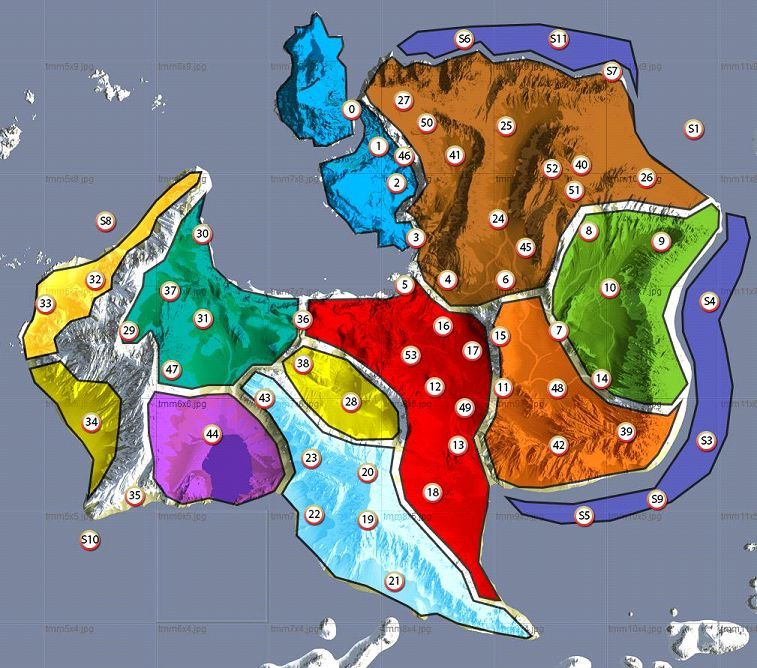
Among the documents of the massive The Witcher 3: Wild Hunt design leak happened today there was something very interesting: the map of the island of Ard Skellig, which is the largest landmass in the Skellige archipelago.
You can see it below, and here's how the document describes it.
After establishing the regions of Ard Skellig, we had a startup layout to begin scattering points of interest that make consistent sense and serve as gameplay and/or navigation spots. The density allows for a constant nav. assistance for the player while leaving enough room for “extracurricular activities”. The POI grid also takes the “offshore section” into consideration by populating the sea around the eastern-mountains with POIs.
"POI" stands for Point of Interest. The document includes a detailed description of all of them, but we won't publish that part in order to keep you safe from excessive spoilers. Suffice to say that most of the encounters sound extremely interesting and there will be some out at sea as well (and not just with fishes).
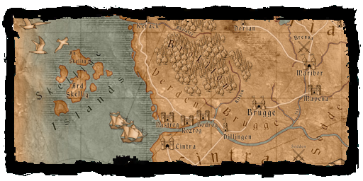
It's worth mentioning that while extremely big, this is not the whole map of the game. Ard Skellig is just one of the islands that form the Skellige archipelago (even if we don't know if all of them will be explorable). We included a second map at the bottom so you can see the whole archipelago, courtesy of The Witcher Wiki.
The whole playable area of Skellige will be 64 square kilometers, and there will be two other major areas in the game in the form of Novigrad (which is even bigger than Skellige) and No Man's Land.
As usual remember that this is work in progress, so the points of interest marked in the mark can very well be shuffled and moved around, and more could be added before release.
Incidentally, this is the last thing you'll read here on DualShockers about today's leak. There's a ton more, but everything else is either too technical to be interesting or massively spoilerish, so it won't appear here.


